Somerset Trough Project
Somerset Island, NU
Copper exploration in the North.
Proven potential in a frontier terrane.
Location

Project Area
3750 km²
Strike length of prospective belt
~360 km
Grab samples
up to 8.99% Cu
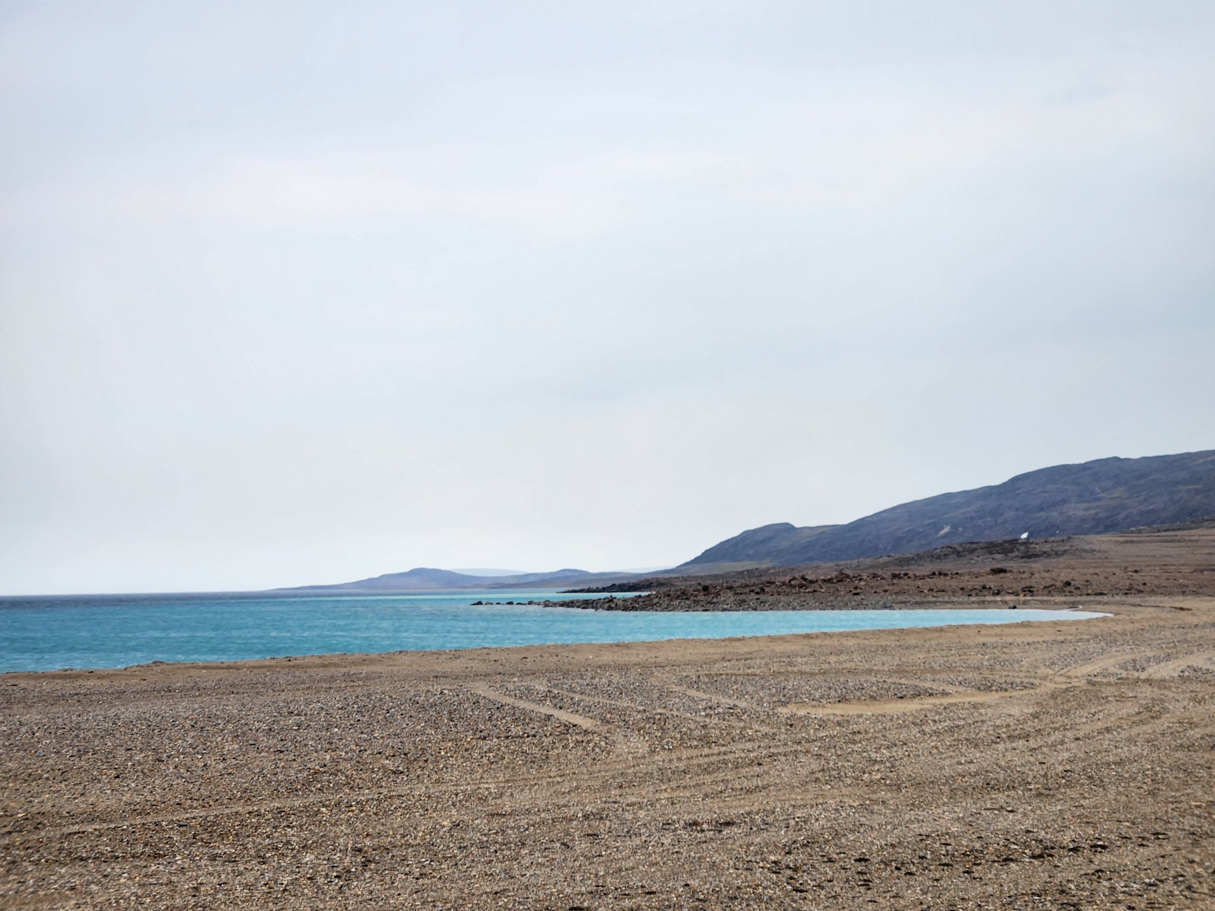
The Somerset Trough is a grassroots exploration project on Somerset Island, Nunavut, Canada, comprising nearly 4000 sq-kms of tenements, wholly owned by Bronzite. The Property is located through central and southern Somerset Island, Nunavut in the Canadian arctic. It is situated between Resolute Bay to the north and Taloyoak to the south. The nearest major city is Yellowknife, NWT, which is located 1342 km southwest of the project. The project area extends over both the Qikiqtani and Kitikmeot regions of Nunavut.
Community and Environment
The Project covers the entire western edge of Somerset Island in Nunavut. Although Somerset Island itself is uninhabited, people from the surrounding Inuit communities occasionally use the land predominately for fishing and whaling. Notable areas of community use are Creswell Bay in central Somerset Island and Fort Ross, on the southeastern corner of the island. Wildlife in the project area consist mainly of sparse muskox herds and arctic wolves. Caribou, which historically occupied the northern and northwestern parts of the island, are largely gone from the region and are seldom observed.
Part of Bronzite’s mission is to ensure the environment and wildlife within are project area are not disturbed by our exploration activities. Part of the work that Bronzite intends to complete as the project develops are detailed environmental and wildlife studies, as little data have been collected in the region in the past. We are committed to fostering good relationships with the local communities, sharing the knowledge of the environment that our project brings, and supporting traditional hunting and land use activities by the surrounding communities.

Geology
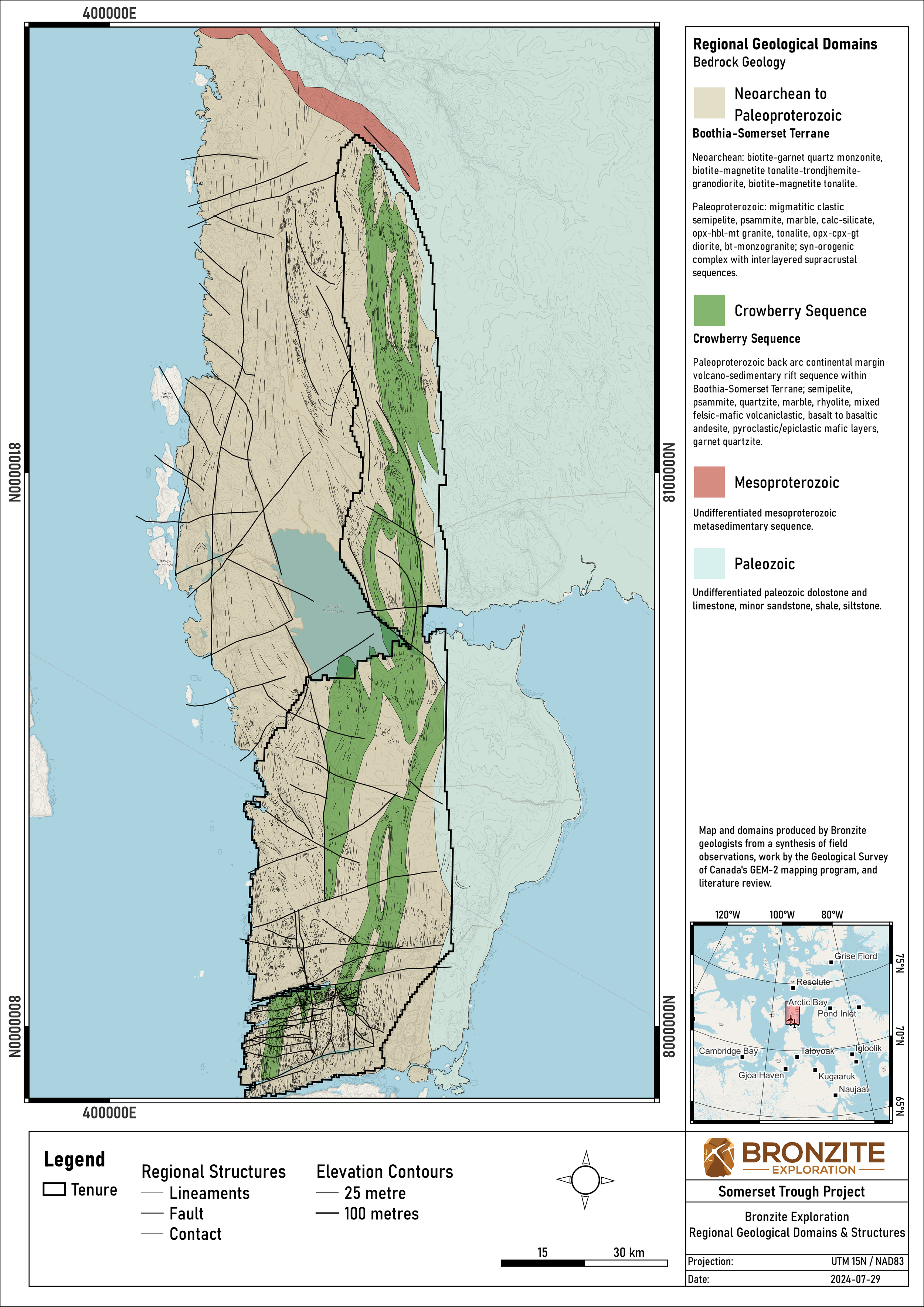
The Somerset Trough is a Paleoproterozoic granulite-facies volcano-sedimentary rift basin situated within the Boothia Terrane; a newly recognized tectono-metamorphic belt situated on the western margin of the Rae craton. The evolution of region was marked by several discrete periods of magmatism, deformation, and metamorphism. Poly-deformed Archean to Proterozoic rocks of the Rae craton form the basement of the Boothia Terrane. At least three separate tectono-metamorphic events have shaped this terrane: the Rae Orogeny (2650–2600 Ma), the Arrowsmith Orogeny (2450–2300 Ma), and the Thelon Orogeny (2010–1900 Ma), which is temporally and spatially related to the formation of the Somerset Trough. Additional thermal and structural overprint ca. 1860 to 1790 Ma, possibly related to the far-field effects of the Trans-Hudson Orogeny, further modified the region after the rapid closure of the Somerset Trough rift basin.
Prospects
Somerset South

-
The Crowberry prospect is hosted within a package of metavolcanic rocks with compositions ranging from basalt to andesite. The prospect is offset into four main zones by a series of late brittle EW trending faults. From north to south these are: the Main Gossan, Middle Gossan, South Gossan, and Garnet’s End. Massive garnetite/garnet pyroxenite is present over ~800 metres of strike length and forms as a replacement of metabasaltic protolith. Lenses of massive sulfide, predominantly pyrrhotite with minor pyrite and chalcopyrite, are present over ~1.6 km strike, and their apparent thickness appears to correlate with the thickness of adjacent garnetite bodies. Massive sulfide is typically in contact with deeply weathered garnet biotite schist and appears with mineralized pyroxenite where alteration is the strongest (main gossan, middle gossan, and south gossan zones). Malachite staining is present on some massive pyrrhotite and garnetite.
-
The Cranberry prospect occurs at the boundary between the lower and upper Crowberry sequence in the West Crowberry area. Here the upper Crowberry sequence is in fault contact with the Coastal Migmatite Domain and is only about 250 m thick. Mineralization at Cranberry occurs within metabasalt and paragneiss. There is a domain of rusty-weathering paragneiss and intercalated metabasalt orthogneiss about 200 m long and 50 m wide that appears stratabound and is associated with locally crosscutting veins and sills of tonalite. It extends for several hundred metres north and south as several layers of rusty-weathering exhalite or iron formation. A small occurrence of garnetite or garnet-rich pyroxenite associated with semi-massive sulfide < 1 m wide occurs on a small ridge north of the main showing. However much of the Cranberry prospect area is under overburden.
-
The Blueberry prospect occurs in an F-1 fold refolded by F-2 about 8 km NNE of Crowberry. The lower Crowberry sequence appears within the core of a large syncline. The interior of the fold structure is composed of gossanous metabasalt that is variably altered to garnetite, garnet-rich pyroxenite, and garnet-biotite schist all of which are strongly mineralized with pyrite and/or pyrrhotite. The mineralized zone is approximately 300 m x 300 m in extent. There are increasing amounts of paragneiss towards the boundary with the upper Crowberry sequence as shown on the map. The Blueberry prospect resembles a more proximal expression of a Crowberry-like mineralizing system.
-
Main Cloudberry Showing
The main occurrence in the Cloudberry prospect area is a zone about 200 m x 200 m of pyritic metabasalt, pyroxenite, and garnetite within the typical Crowberry orthogneiss-paragneiss sequence. There are several occurrences of quartz-rich exhalative material and a ridge of coarse-grained garnetite closely resembling that at Crowberry. Much of the mineralization occurs in pyroxenite along with semi-massive sulfide lenses. It appears that here the upper part of the Crowberry sequence has been removed by faulting, and the sequence faces up to the SW into Eastern Paragneiss Domain across that fault. This occurrence resembles a proximal equivalent of the main Crowberry garnetite and pyroxenite. It is flanked by iron formation and exhalative rocks over strike lengths of several km.
Cloudberry South and East
The Cloudberry South and Cloudberry East prospect areas are located along the (folded) trend of iron formation and/or exhalite that extend southward and thence northeastward around a fold nose displaying several significant gossans. Whereas typical iron formation or exhalite horizons in the project area, like the ones flanking Crowberry, are about 5 to 20 m thick, the ones along strike with Cloudberry range from 25 to 100 m in thickness. Where they include larger amounts of sulfide and especially where steep topographic relief has encouraged mass wasting and rapid weathering, these units generate strikingly large gossans with dimensions in the hundreds of metres.
Results
Rock Samples
Cu up to 8.99%
Zn up to 2.25%
Ag up to 25.9 ppm
Scale Potential
~360 km strike length of prospective volcanic belt
Discovery Potential
District-scale potential in a newly discovered tectonic belt